What it looks like inside
These are real screenshots of the app during a storm afternoon in southeast Arizona.
yourdomain.com/app
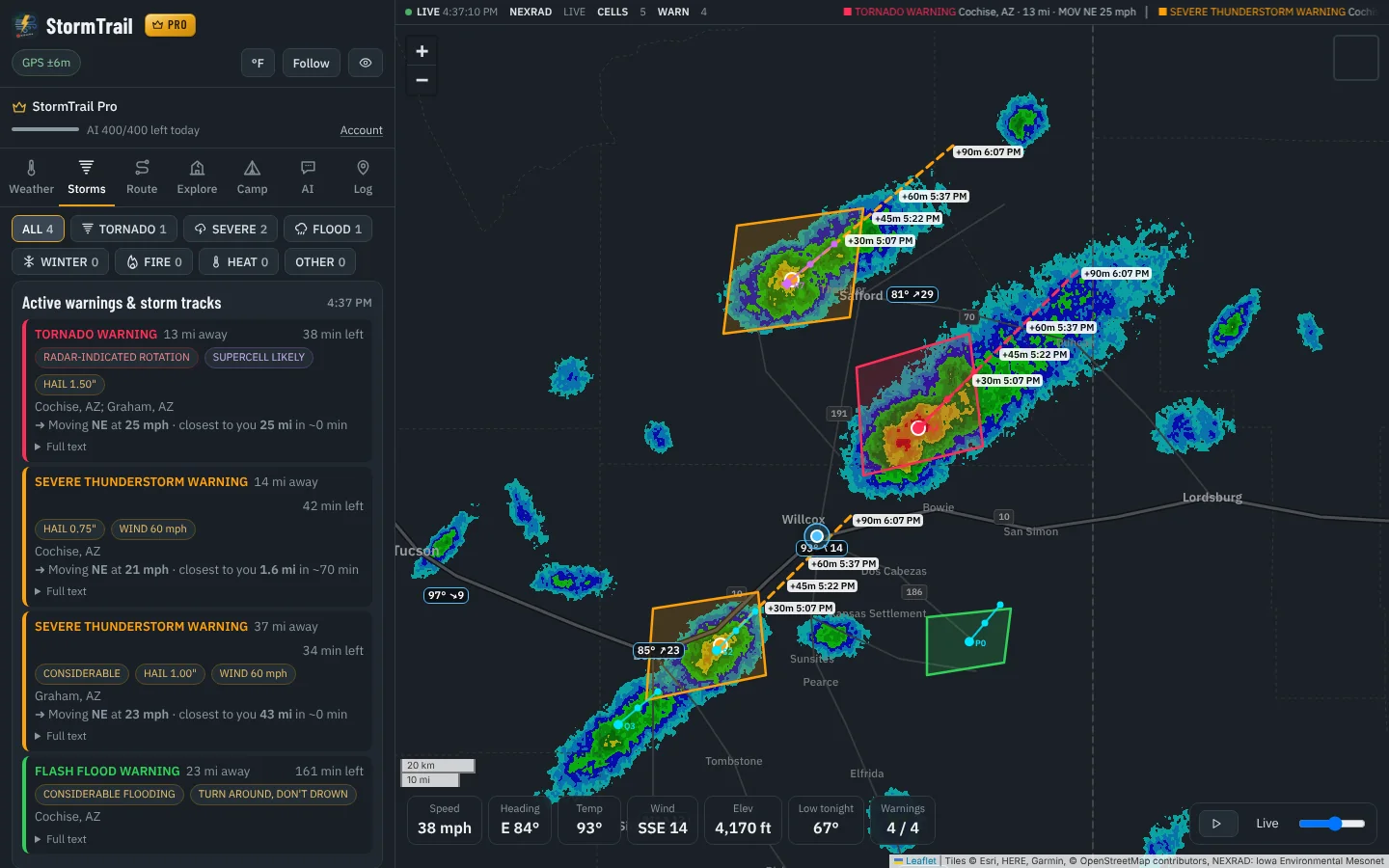
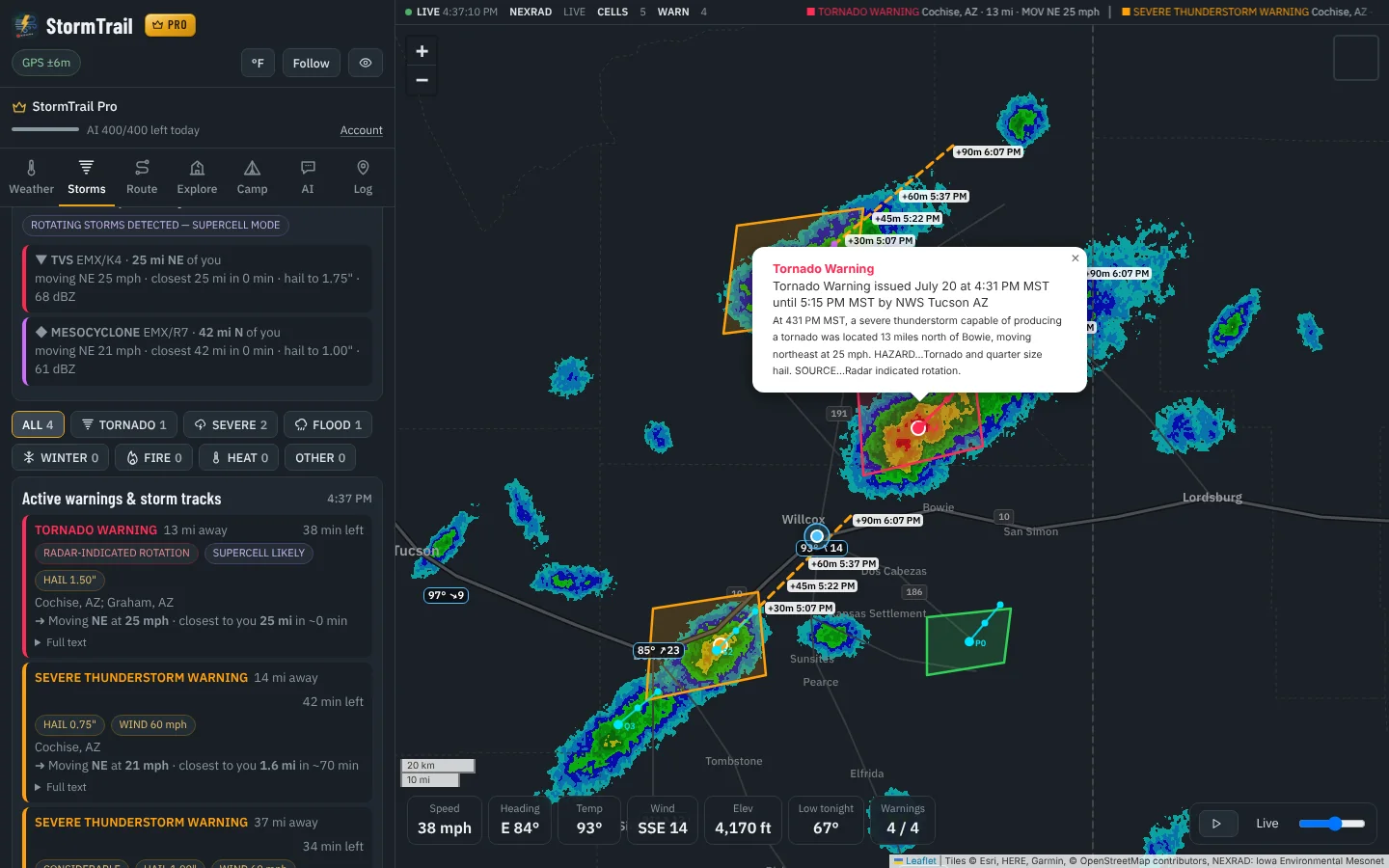
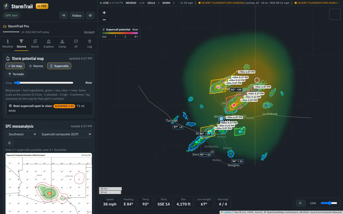
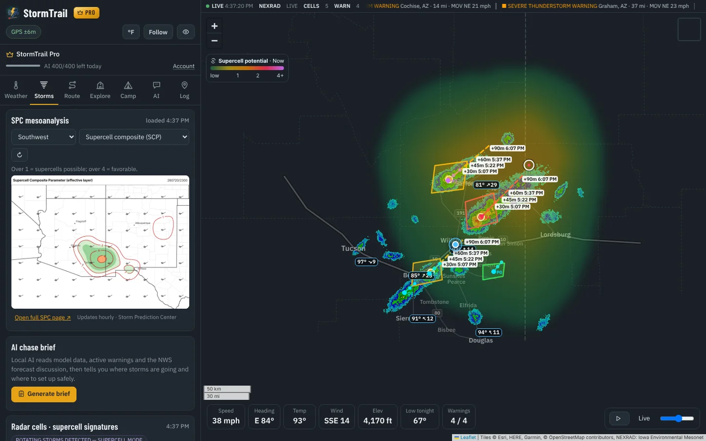
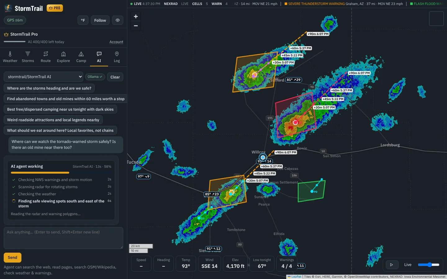
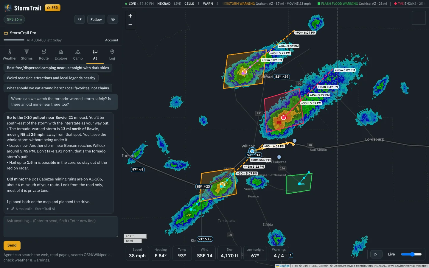
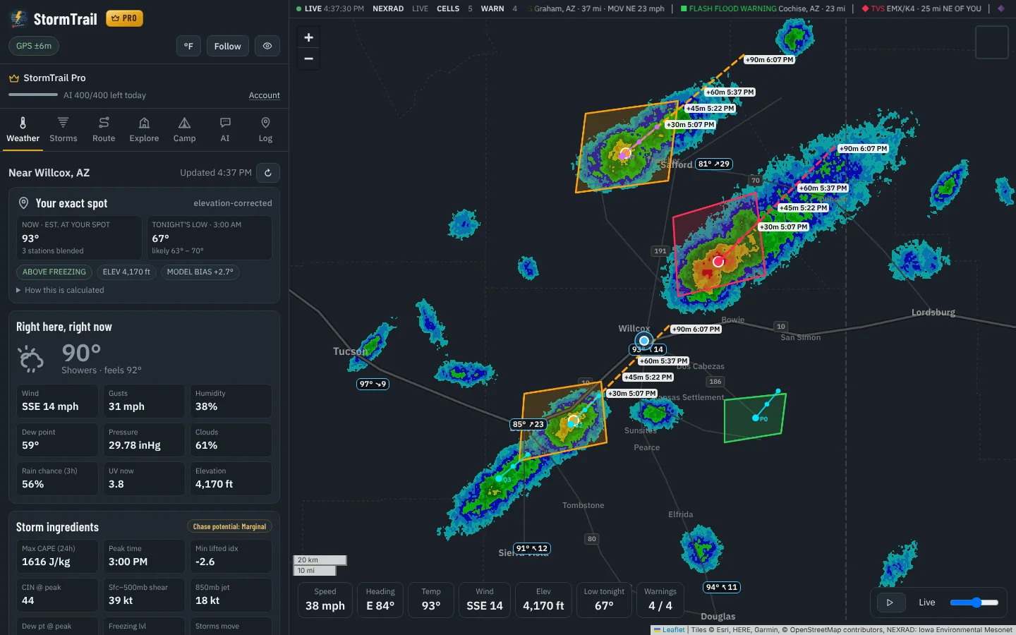
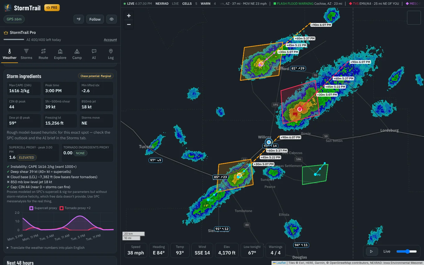
Radar, warnings, supercell maps and routes on one live map that follows you. Plus an AI co-pilot that finds safe viewing spots and digs up forgotten mines and ghost towns between storms.
These are real screenshots of the app during a storm afternoon in southeast Arizona.
Everything a chaser checks on five different websites, on one map that follows you.
A soft color layer over the map shows where supercell and tornado ingredients come together, from green to red, for the next 24 hours.
Radar-detected rotating storms and tornado vortex signatures, with their direction, speed and when they'd pass closest to you.
The Storm Prediction Center's supercell, tornado, CAPE, shear and helicity maps for your region, explained in plain words.
Every NWS warning near you, drawn with its projected storm track, plus an alarm if you're inside one.
Looping NEXRAD radar, the closest official weather stations, and tonight's low corrected for your elevation.
Your drive colored by the forecast at the time you'll be there, with any warnings that cross it.
Ask it like you'd ask a local. It checks the radar, the warnings and the map before it answers, then pins what it finds.
“Where are the storms heading and are we safe?” “Dark-sky camping near here tonight?” You'll see each step it takes.
“Find the best supercell spot this afternoon and route me there.” It scans the setup, pins a safe viewing spot and plans the drive.
Searches Reddit, forums, blogs and history sites for little-known mines and ghost towns, then pins every lead it can place.
Campsites, water, fuel and hospitals nearby, plus sunset, moon phase, a stargazing score, frost risk and a trip log you can export.
Start free. Upgrade when the season starts.
New accounts get Pro free for 7 days, no card required. After that you stay on Lite unless you subscribe.
No. Every new account gets Pro for 7 days. After that you stay on Lite unless you choose to subscribe.
Each question uses one credit. A chase brief uses 3 and a Deep Dig uses 10. Lite gets 15 credits a day and Pro gets 400. They reset every day.
Yes. Open StormTrail in Safari or Chrome and add it to your home screen. It opens full screen and uses your phone's GPS.
No. StormTrail shows official NWS data alongside its own estimates. Always follow NWS warnings and local officials, and never drive into a storm.
Go to Account, then Manage billing. You keep Pro until the end of the period you paid for.